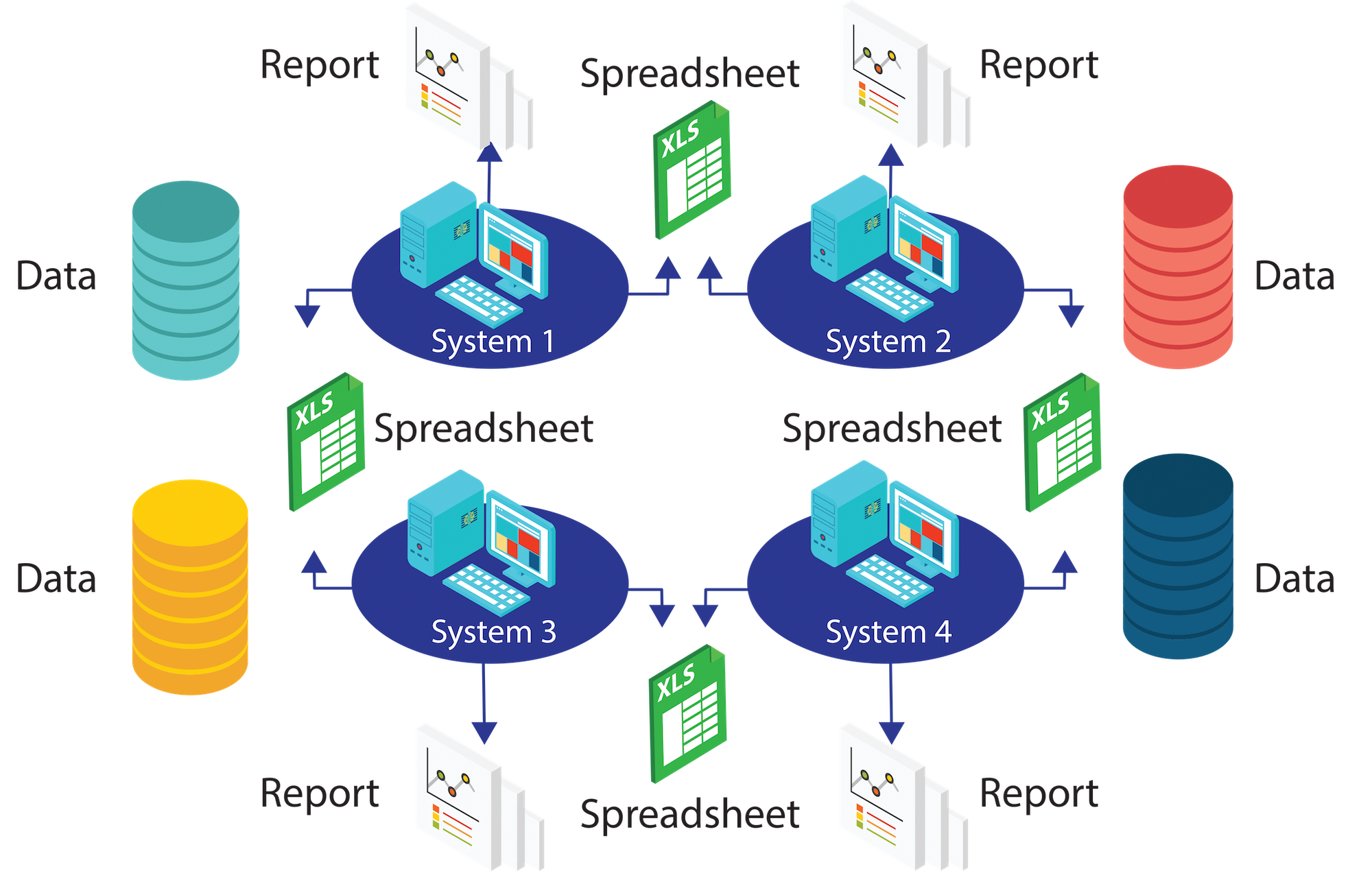
Challenges
- Utilizing spreadsheets to collect and manage data was difficult to manage
- Unclear knowledge of current inventory and condition of equipment
- Impaired data creating subjective based decisions
- Needed Asset Management at the Enterprise Level

Client is one of the most affluent County Governments in the United States, with over 100 properties within their commercial real estate portfolio. Client was using spreadsheets to collect and manage information regarding critical equipment and fixed assets at all of its municipally-owned locations. They desired to be able to establish an enterprise-wide asset management program. Wanted a partner who could help establish a technology road map to enhance capital planning objectives and provide superior decision-making insight. They partnered with Geospatial Analytics® because of the team's extensive asset management track record, "agile-yet-simple" technology solutions and strong project team credentials.

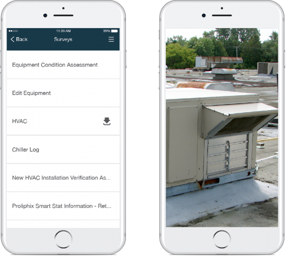
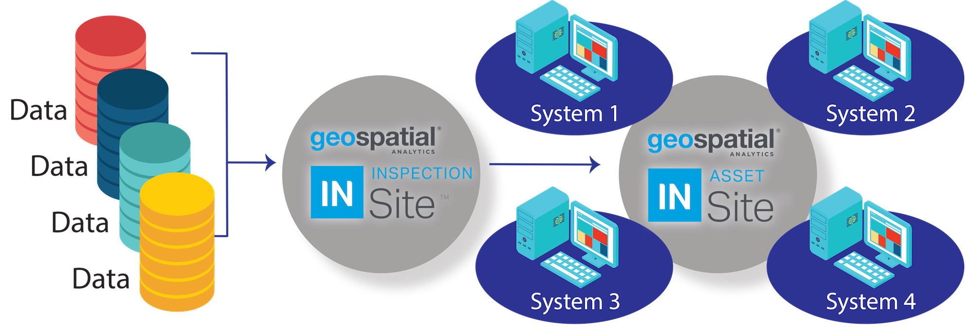
To address the unwieldy use of spreadsheets to capture data, Geospatial Analytics® helped the client implement a mobile inspection form that created a consistent and efficient method of data collection.
Geospatial Analytics® configured the inspection template to specific items that the client required. The client could make immediate changes to the template as new requirements were identified.
Geospatial Analytics® quickly and easily deployed the mobile inspection form, without the need for significant training or support.
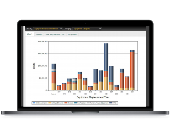
The team deemed that aggregating data obtained from inspections was critical to the success of the effort. Leadership needed the ability to easily obtain information on specific pieces of equipment, but also create comprehensive portfolio views. The information obtained was also needed to updated the Client's property management objectives, as well as work with their current facility maintenance platform. Geospatial Analytics® helped the Client implement a web-based portal where inspection results were automatically stored and could be used in support of facility maintenance and repair activities.

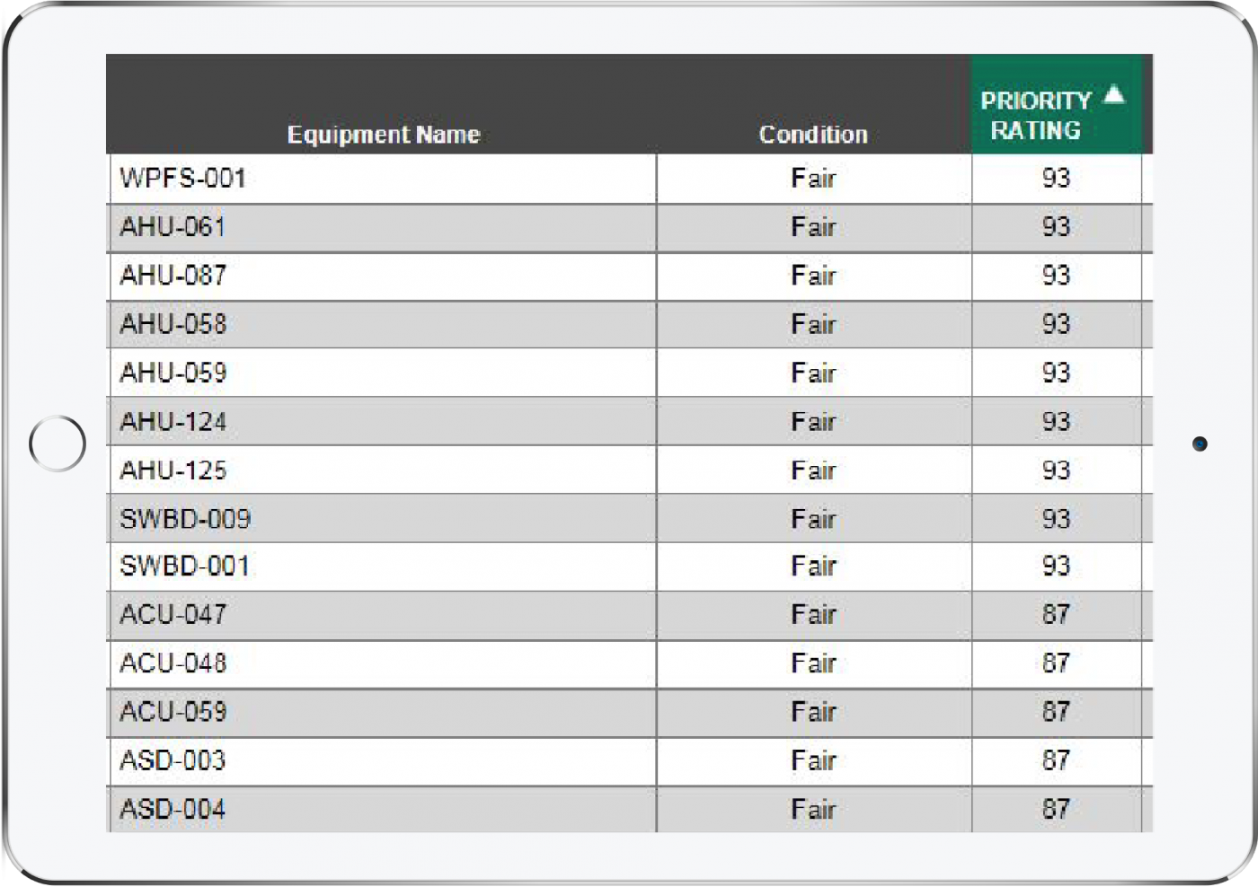
Geospatial Analytics® supplied a robust set of capabilities for an enterprise-level asset management program, including analytics and scenario modeling.
Use of various levels of Uniformat codes and a facility condition index (FCI) in the tool created a fact-based, objective decision support environment.
The asset management program could consistently and objectively track assets' original value, condition, and life expectancy to properly manage risk and create accurate financial forecasts.
Case
Studies
Cost Benefit Analysis
More
Solutions